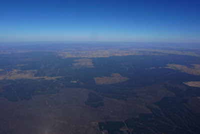
 NESBITS RD. Well, I’m in the air, but it all feels uninspiring. Got a great tow from Ron, released above 500m, and concentrated on staying in the lifty air. Ron said yesterday that it was very slow going down low but the climb rate improved with height, and down low here it is very slow. There’s a lot more wind up here and it feels strange to drift with it while circling – I’m used to noting a trigger point on the ground and circling up over it. Still, with this wind pushing me all I really have to do is stay in the air – over time it will do the real distance work for me!

FINLEY – Woohoo – still in the air!! Finley is the 70km mark and the climbs have finally started going a bit higher – there must be a low inversion. But after grubbing along low for so long I'm now at the lofty height of 1,700m and feeling fantastic! Either that or I’m figuring out how to stay in the thermals better, but I think there was a layer of something that is slowly lifting. It seems to work better to face into the wind for a bit, easing left or right to stay in the better lift until the climb rate just starts to drop off, then swoop around downwind before facing into wind again. However even when facing into wind I’m still flying East, just backwards! Low down it seems to work best if I watch the wing and just concentrate on feeling what the air is doing – looking at the ground is more of a distraction than a help.
PAST BERRIGAN. I’m getting pretty low again... but I’ve just passed the 100km mark! Still, I’m a few km’s north of the Riverina Highway so it’s probably a good idea to get closer. There’s a green paddock, a couple of small patches of bush, and a tree-lined road with a canal on one sidethat all line up sorta towards the road so I’ll fly over them and hope the temperature change or wind shelter or something triggers a thermal off one. It’s still before 4pm - Ron launched after now yesterday and flew 100km so maybe if I can stay up I could make 200km!! That’d be amazing... and theoretically quite possible... just gotta stay in the air...

I keep the radio volume very low mostly – occasionally turning it off when I’m low and it’s cluttered with traffic like recently. Here's a sample - “yeah, yeah, nah, bring ‘er back a bit George, bit more, bit more, woah, that’ll do ya, nar so I says to ‘im ya mus’ be dreamin mate, what’s it made a’ gold or something – there's a latch on the side matey – and ‘e says it’s nearly new, so I says Yere right, ya mean ten years ago maybe and ‘e says....etc.” You get the idea. I’m sure it’s users like this that inspired privacy codes!
More interestingly, I could hear a flying instructor coaching students on the finer points of ridge soaring and pointing out good thermal triggers for a while - I have no idea where they were or what they were flying but the company was fun.
And I’m at 150km! And there’s still plenty of sunlight left! I’m going to start working north – I know Albury airspace extends out to somewhere near Holbrook? – and starts just after the Hume Highway – maybe I’ll reach that far!

Back a few km’s I noticed a sailplane circling way below me to the north. There was another one several km’s behind it, then one flew by under me, and just then one flew south a few hundred meters overhead. Fun to have some company in the air - I guess they’re from Corowa, or maybe Benalla.
FURTHER EAST. Another town that I don’t know the name of is passing underneath. The GPS says it’s on the Olympic Highway, it’s got some distinctive silos in the middle of it, and I’m sure I’ve driven through it in the past. But the nice thing about it is the lift it produces – light lift for a couple of km’s past it, then strengthening into one of the best climbs so far. The Hume Highway can’t be that far ahead!!


Being very comfortable with the Aspen2 helped a lot, as did all the hours of scratching in light lift on poor days. A couple of musli bars, a bannana, and occasional sips of water helped keep the energy levels up, and taking pics, leaning back and watching the wing on high glides, and fiddling with the GPS provided welcome breaks for the mind. The GPS says that time in the air was 6hrs 35min and straight distance was 288km - with waypoints added the xc distance comes to 301.7km. 300km!!!! That’s just so far past anything I’d planned or dreamed - it's majorly redefined what I thought was possible by a regular pilot on a regular paraglider - even on an extraodinary day.
Checking my flight on Google Earth I can see my ideas of the airspace steps weren’t very accurate – it starts just after the Olympic highway (not the Hume), and while there is a step up that ends near Holbrook it’s the 3,500’ to 4,500’, not the 4,500’ to 8,500’ one I thought. I had some airspace waypoints marked on the GPS, but they were mostly dealing with the airspace sout-east of Albury, and weren't very helpful to the north. Furthermore, I was a bit intimidated by the size of the bush crossing and took the thermal before it as high as it would go, climbing past 3,000m. I'm a bit puzzled by my max height as I remember looking at the XC Trainer when the roughness eased off at the top of the climb and seeing that I was above 3,000m, but I'm sure it said I was a good 300m below what my Garmin recorded. Measuring heights and distances on GE I see that I didn’t need all that height, but then again if I’d flown across lower and hit 3-4min of good sink I might have.
More pics of the flight here.
A very big thanks to Ron for convincing me that today could well be worth waiting for, putting me up for the night, the super tow in the morning, and lending me his SPOT GPS tracker and encouraging me to go big.


1 comment:
Congratulations Bill...lovely flight :-) Your account and photos make me even more excited about my up and coming 3 month trip to Oz in 2 weeks.
Tell me, your account says you were flying with SPoT in you harness. We are doing tests in the up coming XC open in Manilla in Feb, but from what we have worked out already SPoT might not work too well if inside a pocket or harness. What did your track on SPoT show. Did it actually send every 10 mins? Any feedback you could share would be very welcome.
Once again - fantastic flight, you must be over the moon still!
Gaynor (Flygirl)
Post a Comment