Monday, October 5, 2009

Fun flying at the farm

The wind on the hill was S-WSW today, so just before lunch we headed up from some tandem flights. Phil was first...

...and after launching we hung around a bit in the patchy lift before the wind swung slightly more to the west and mostly just blew along the ridge.
We landed, did the vehicle shuffle, and Heather was ready for the next flight.


The wind had picked up a little, and she was lighter than Phil, so pretty much as soon as I pulled the wing up she was lifted off the ground.

I tried to run forwards but was lifted into the air after a few paces as the wing started flying slowly forwards.
The slope at the top of the hill is a very gentle one, and although we touched down briefly once we were soon in the air flying out from the launch.
There was more lift during this flight and we climbed above launch height as we (slowly) headed out from the hill before landing in the valley.

Next a short flight with Phil from the top (wind had picked up slightly more, had difficulty controlling the wing while checking lines before we were attached) but once in the air it was all good. We got above launch and flew along the ridgeline some before landing on the top of the ridge further down (near the farm truck for an easy retrieve).
The wind had slowly increased still more and I decided to leave it for a while.
As the sun started to get low I headed back up with Dad for a final check and we arrived on launch to find the wind strength perfect but the direction slighty cross. Fine for launching, but the direction was the similiar to earlier in the day and just 10-15degrees more to the south would have caused a mega lift band out the front of the hillface, rather than small, ever changing patches of lift swinging around the peak of the hill and windy sink to fly through in front of the hill to get over the flats to the house.
The view on launch was amazing - the sun was about 15min from setting, the massive clouds deeper in the mountains were golden pink hues - half of the horizon looked like a movie set backdrop or a photoshopped postcard!

We launched into the smooth evening air and found the lift better than we expected - by soaring the crown of the hill we got up to 650m as the sun dipped down to touch the horizon and slip slowly over the edge.
The lift eased off and we slowly flew out from the hill, over the flats and down to land in front of the house. It wasn't a long flight, we didn't go very far, or high, or achieve any of the other big numbers that often make up a great flight - but it was great nonetheless.
The smoothness of the air, the sound of the wind in the lines, the unfamiliar viewpoint of familiar places in the last light of evening- combine that with the thrill of flying with my Dad (we've flown together before, but never as good a flight as this from the hill) and it all added up to pure magic. All the difficulties of paragliding become insignificant and forgotten when days and flights like this are possible!

Sunday, May 17, 2009

Soaring at Mt Oates

I rushed up the hill when I noticed that the wind was blowing pretty much right on the face at a soaring strength (very rare except just before a thunderstorm hits). Didn't get much height as I flew away from launch until I got out over the main face, then the lift was good with a nice wide lift band.
Some pics...


Take-off is the bare patch on top of the hill (plenty of room hey?) in the center of the pic.

Looking down the valley...

Recently repaired dam (wall damaged by flooding, we cleaned years of accumulated silt out of the bottom as well).

Sunday, April 5, 2009

Making the most of the day!!

What a great spot to be at lunch time!! Brett (the far pilot) and I talked about making a run over to the Kiewa Valley if the day looked good enough (xc skies was predicting a light SE and good climbs) and we took off just before 1pm to check it out.
I didn't find anything over Marcus until I got over the second 'bump' where I took a tight little climb up to 1,000m, then searched around for the core - the air was going up everywhere as I flew back towards launch and I knew the core would be worth finding. I found it just over launch and it was good, peaking at 5.5m/s and taking me up over 2,100m. "Woohoo! The day's goanna be epic" I thought, and headed across to Goldmine. Brett was already over there and had gone down the ridge a ways - see him?...
... I didn't find anything as I approached or flew over the ridge but I'd gotten a 13:1 glide over so I kept going towards Pyramid. I arrived over the lower point with plenty of height, but there was no lift there so I turned right and headed in towards the second point, pretty happy to have bypassed two climbs that I usually need to take. I arrived there and still no lift! Weird, I'd thought I'd be getting sucked into screamers over Pyramid if Mystic was giving off 5.5m/s climbs - maybe the climb is further along... Nope! Only more sink...
Now I was low, just over the trees, and in desperate scratching mode - following the ridgeline down and circling in anything that would even keep me up. Lower and lower with nothing to indicate any nearby lift.... I stopped to circle in zero's at the lowest point of the spur (bottom left of the pic above), wondering what had gone wrong with the day and my thermal spotting. There was plenty of sun around, light wind on the hill... so where were the thermals???
Well, one of them was underneath me, it turned out. The zeros slowly became ones, and then the climb steadily improved until I was happily climbing at 2-2.5m/s back up to 2,000m.
I headed in towards the top of Pyramid for a top-off before crossing the Tawonga Gap and straight away was flying in sink. I had a 2:1 glide in to the top of the hill and didn't have much time to play around there as I was still going down. No thermal off the top, sink down to the second point, still no lift... it was all feeling horribly familiar as I got lower and lower. Half way down the ridgeline I finally flew into a light, drifty thermal which averaged 0.9m/s for the next 20min. It was drifting quite a lot too, but that was good because by the time I left it I was already a third of the way over the gap and back around 2,000m. Interestingly, each climb had topped out 100m lower than the one before... I was very keen to avoid any more 2:1 glides...
... Landing on the road below HAS been done before, but it's not the sort of thing you'd wish on anybody - I flew very slow and made the most of the light lift downwind of the thermal until I was safe within an easy glide of the Kiewa Valley landing options.
The glide was good and I arrived over the ridge-line with over 1,700m asl, which steadily reduced no matter what I did. I sank as I flew on the right side of the ridge (the SE wind should be carrying the thermals over to somewhere around here...), I sank as I flew on the left side of the ridge (Huh! Maybe it's triggering earlier, or maybe there's a valley wind that's carrying the lift the other direction?), I sank when I flew over points (why weren't they triggering??), I sank when I flew over saddles. There wasn't even the hint of lift around, and by this time I'd discarded so many theories about what was happening and was totally confused. I arrived at a bowl and was low enough that I had to stay and either climb out or bomb out. My average sink rate slowed and finally there were clues of lift around - short scraps of lift that would lift half the wing and allow me to do half a turn or so before they were gone - but at least I wasn't sinking out any more. I bobbed up and down, exploring the lift and trying to find out where it was coming from (or going to), gaining a couple of hundred metres, before it all disappeared. Bugger.
I didn't have enough height to cross the valley (at least there were some clouds over there), or even make it to the next bowl up the ridge, had no idea what was going on with the air, and needed to go somewhere fast because the sink was increasing again. Just before my radio had gone flat (AAA Alkalines just don't handle the cold as well as Lithium-Ion packs) I'd heard from Brett (ahead of me) that he couldn't figure out what was happening on the hills and was heading into the valley. Oh well, if what you're doing isn't working - do something else!
I flew out over a spur (maybe... maybe...no.), had a bit of a wander up over the tree-line (nope, that's not working either...) and flopped into the valley.
Now a while back I flew from The Pines on a fairly stable day - I just couldn't seem to get over 1,400m for ages and in a burst of unquestioned insanity I bashed upwind for most of the afternoon (away from much higher looking clouds 30km downwind...) but I did learn one very useful thing - when you're low vineyards can be very reliable triggers.
And there were a succession of vineyards sprinkled up the Kiewa valley. Yay! I headed for the nearest one and it worked again! I climbed from 700m back up to 1,500m, then at the next vineyard from 850m to 1,500m, then again from 1,000m to 1,300m - where I headed for the top end of the little side valley on in the right center of the pic below.

You'd think I would have learned by now...I found sink where my paragliding knowledge said there should be lift.... sigh, heading along the ridgline, getting lower and lower, being tempted to head towards the road to save some walking when I landed (which usually results in less walking, but always results in less flying), but there was a gap ahead - if there was no lift here (a good trigger point if the valley wind was all back-to-front) I'd head for the road. But... there was lift!! A tight but welcome climb that lifted me from 700m back to 1,450m!
Here I used my experience to do a smart thing by flying crosswind to a nice point (baking in the sun with the wind presumably blowing up it's face) of the N side of the valley where I could catch a thermal up through the 1,500m valley inversion and finally get some good height and fly along the peaks of the ridgeline.
Except... there was no lift there! And lots of sink! I couldn't believe it! The wind was doing very different things at different levels and I'd thought I'd nearly be able to ridge soar that face until I did get a thermal. Ahh well, back down the same sinky ridge line I'd followed before, back to the same point I'd climbed out of 20min before, hmm, no climb... keep heading down the ridge I guess.... What is with today? Maybe I should just do the opposite of everything that I think of...
A bit further down I found a climb that was so light and delicate that it took every gram of concentration that I had to stay in it meandered slowly along at the mercy of the wind. I was staying with, flying it like a flatlands thermal, and it drifted me back onto the ridgeline I'd attempted to get up on before. It disappeared, re-appeared, disappeared again, and I left, then there it was again for a few turns, then gone again, then gone for good but by then I was at 1,300m (funny, since 1pm every thermal seemed to top out lower than the one before...) and in a really light convergence zone from the wind blowing out of Happy Valley opposite me. And, I was over the northern ridgeline.
Dramatic burntout patches from the Feb '09 fires were sprinkled along the hills and ridge around me, but these were the later, slower burning part of the fire and hadn't caused much damage (burning small trees, bushes, and dead branches on the ground, browning the established trees but not killing them).
From this point (above right of my shoes in the pic below) I got another slow, drifty, sortof climb that got me most of the way across the the bowl behind it -and fed into a genuine thermal - 2.8m/s back up to the spectacular heights of 1,850m!! Woohoo!! A good climb after ages spent grubbing around low always feels fantastic! Being able to finally relax, after the intense concentration required to beat whatever obstacles you have been fighting, is such a release! And the view is much better by then too!! And if it's late in the day and you have been nurturing the suspicion that the day has died for a while, it's just great!!
It was late in the day, but I was over the hills on the right side of the valley finally, with a tailwind behind me and smooth late-afternoon conditions ahead. Yeehar!!!

Lookit the view! Lookit how far I've come!

I cut the corner of the next bowl and gliding along the ridge in smooth air, weightshifting to work every bit if lifty air I could find, and slid over Savhill about 300m over the takeoff. I was hoping for a late climb from here but didn't find one. There was a cloud of dust heading down the new track though, which looked like Michael's truck (Dozer driver who's been making the track for Bob). I gave him a ring on the mobile and, sure enough, it was him! He had just knocking off for the day and soon spotted me as I flew over - we had a quick chat and he told me what the wind was doing at ground level. I didn't find any lift to speak of over the next few bowls but the air was warm and smooth and the late shadows and sunlight made the view spectacular.
All too soon I was doing a final circle to check the wind strength and direction, making sure the camera was secured in it's bag and the flight-deck all zipped up, looking hard to make sure I hadn't missed any powerlines, final approach, crabbing along downwind of a road and powerline, kicking the legs to make sure there's plenty of blood flow and they'll work ok, standing up in the harness, a bit of brakes, watching the ground, brakes up.... flare... and down.
The steady wind in my face is gone, the ground is firm and steady beneath my feet, my wing - which has been moving above my head and telling me what the air is doing for the last four hours - is suddenly still and quite - just a pile of material and string now. Just material and string.
I slowly pack up, savoring the afterglow of the flight, remembering the beauty of the late shadows, feeling the muscle aches from hours in contact with the harness that I never feel while flying, wondering how I'll get back to my car....

I hadn't organised a retrieve and decided to hitch hike until I ran out of daylight and then think about ringing a friend. Hitching back to Bright from here doesn't work very well, I've found, because you either have to take three (or four) lifts if you go via Happy Valley and Ovens, or at least two lifts if you go via Tawonga. The problem is as you run out of daylight less and less cars come past and nobody wan't to pick you up after dark. So I decided to make for Wodonga instead. It was much closer, I could stay the night there and retrieve the car (and maybe fly again) in the morning. Even though I was on a back road I'd only walked a few km's before a nice old guy in a semi stopped for me. Once we had the wing up in the cab (looong way up) we headed off. Tom was on his way back to the farm north of Holbrook after delivering a load of hay to the fire affected farms down in Gippsland. He insisted on dropping me off at the doorstep of where I headed for - no mean feat maneuvering a rig that size through the streets of Wodonga. Thanks Tom, it's people like you that make the world a better place.

Wednesday, March 18, 2009

Bright Open - Day 5


We flew today - task 2 - and it all went pretty well. No one hurt, 4 in goal (that I've heard of). I didn't make it to goal, I couldn't punch through the wind from Mystic towards the second last turnpoint.
The course was: Start - Goldmine, TP1 - Smoko Ridge, TP2 - Blackfellas Peak, TP3 - Little Mystic, TP4 - Porpunkuh Bridge, TP4 - Little Mystic, Goal - Mystic LP. Total distance - 51.7km.

Things I think I did right:
- Didn't launch straight away. It was a good thing to put off the stress of the gaggle for an extra 30min.
- Was near the down-task edge of the start cylinder at the start time.
- Took a pretty direct route to Little Mystic - that saved heaps of time.

Things I didn't do so well:
- Thermal with the gaggles - especially when the air's a bit rough I'm just not used to having lots of glider around me. I like to move around in the thermal and look for stronger cores and it frustrates me to try and circle at diameter of the least efficient climber....
- I should have pushed harder earlier on stay with a faster gaggle instead of circling in a weak climb and getting stuck with a slow gaggle for ages.
- I should have headed direct towards the Porepunkah bridge intead of flying through Mystic - I'd heard that people were getting stuck there and could see them there so I should have avoided it and tried for Apex or at least a glide up the center of the valley.
- Stayed in the strong lift over Mystic when the gaggle joined it instead of leaving (? assuming it would have been safe....)
- Used my height from Mystic to get as far along the course as possible, rather than flying back to land at the Mystic LP.

But all in all it was a good day of flying!

Here's a pic of the field shortly after the start.

Tuesday, March 17, 2009

Bright Open - Day 4

Today was the first flyable day of the Bright Open. It's been really well organised by Benn and Hamish but, until today, the weather hasn't co-operated.
But today we got to fly - and although the day didn't look very good initially (windy, with a really low cloud base and a short thermic period) it turned out much better than expected.
The task committee decided we start at Goldmine before flying to Smoko Ridge, Blackfella's, Freeburg Ridge, and landing at the Porepunkah Airfield.
Launch went well...
...with all the field off pretty soon - and everyone was going up nicely.
I timed my run over to the Goldmine badly and got there late, low, and behind most of the field. After a lot of looking around I eventually started getting high (around 1,600m was high today!) but heard on the radio that the task had been canceled. This was puzzling for me, as the weather seemed fine and I couldn't think why else the task would be canceled - but I could see from the way the other pilots were flying that they were heading down to landing spots so I spiraled down and landed at the Mystic LP. There I heard that one of the pilots had smacked in pretty hard near the Mystic launch while thermalling low and badly broken his wrist and possible hurt his back. An air ambulance had been called, and the organisers wanted paraglider pilots on the ground before the helicopter arrived.

After packing up and trying to find out some of the who, where, how, how bad questions (along with everyone else) we headed back to the Outdoor Inn for some food and to await developments.
Turns out we hadn't been flying for long enough for the task to score any points so as of the fourth day of the comp we are all still equal first....

Once the injured pilot had been flown out a number of us went back up the hill and had a very nice fly in the later afternoon conditions.

I had a really fun glide over to Clearspot with Paul and another pilot on an Aspen2
- formation flying by the end and although we were flying into a headwind it was a pretty boyant glide. After that I hunted around clearspot for a good climb but it wasn't working that well and the highest I got was 1,560m so I headed down towards Blackfellas, then along the ridge towards the airfield. There were little bubbles around, but nothing really worth turning in so I ended up landing at the airfield after Paul. A fun fly!

Sunday, February 8, 2009

Extreme weather

The weather forecast for the weekend was very hot with winds of around 50km/hr in the mountains. But, further west and north there were areas of lighter wind forecasts.... After a lot of last minute phone calls and emails I headed to Deni on Friday night - arriving around midnight. Garry rolled in from Melbourne 1.5hrs later, with a driver, and Benn was driving west from Sydney. By 6am we were on the road driving north of Deniliquin, aiming to get to the lighter winds, tow up, and fly a long, long ways....
While I was listening to the weather warnings on the radio the night before the thought had crossed my mind that maybe I should stick around home just in case of fires - with them in mind the day looked like one of the really bad ones. But the house has been built with fires in mind, is very defendible, and I knew that there'd be people around to defend it if need be so I kept going. Flying wise it looked a bit iffy - like maybe it'd be fine to launch in but maybe it'd be crazy to. One thing was for sure, if we did get up early the potential of the day was huge. Cloudbase was supposed to be above 4,000m and the winds increasing to over 80km/hr up higher.
We knew there would be plenty of lift around - after a mild night the temperature passed 40degC around 10am - and just kept getting hotter. 10:30 and someone in the car said, "Hey does that look like dust ahead to you?" and it was. Pretty soon we were driving through a full-on dust storm, forcing us to slow down as the visibility worsened.
At this point, with more heat and wind yet to come, even thinking of flying seemed insane.
Eventually we arrived in Ivanhoe (the dust storm had mostly lessened by now) where we eventually met up with Benn. He'd driven for a good bit of the night to meet up with us and, several km's behind us on the Cobb Hwy, was forced to stop completely several times as the visibility reduced to several metres.
After discussing options over ice-creams in the Ivanhoe cafe (air conditioned - lovely) we headed north again.
Ivanhoe is supposedly on the border between 'red country' and 'black country' and we soon noticed the difference. Instead of a red dust deserty landscape with occational small stunted trees and lots of roly-poly bushes we were now driving through medium sized scrub sprinkled with taller trees - but not many landing options. In the early part of the flight, when you're scratching in light lift as you drift low over the ground, you really want to have plenty of landing options availeble. Launching in strong winds makes that even more important - the rotor from up-wind obstacles extends further and if you have to land running backwards you may cover some distance between touch-down and when you get the wing under control on the ground - an inconveniently placed tree or fence may ruin your whole day.
After inspecting a potential tow strip about 30km north of the town we returned and waited to see what the day would bring.
About 3pm the wind started backing off so after some chasing around we recieved permission to use the local airstrip to tow from. We set up in the heat (mid forties by now) and Garry launched first, getting away in a light cimb towards the clouds far above us. Ron launced nex, and myself after that. It took me three tows to get away - my first tow I landed about 4km down the road, on the second a radio malfunction occured, but on the third tow I connected with some light lift and drifted off downwind.
By now it was 6:30pm and Ron and Garry had been in the air of over an hour and were way ahead of me - but I was just happy to be flying. Once over 800m the worst of the heat was below me and by 2,500m I was deliciously cool as I circled in the light lift. I knew there wasn't any big distance left in the day but since I was drifting roughly with the Cobb Hwy south the goal was to just stay in the air for as long as possible (hopefully untill it cooled down on the ground).
The flying was really enjoyable and super smooth - so smooth that I took my helmet off and hung it on one foot for a while to enjoy the air a bit more! Visually it was stunning - the red dust, the outlines of old floods and dry creeks making it look like something on Mars, huge areas of dry desert sprinkled with island like clumps of trees, a wall of dust near the horizon to the west (not coming closer - I was watching!), dust devils ripping across the ground below, carrying the red dust right up to the clouds so that their bases had a reddish tinge, the single road visible streatching off into the distance, everything turning to gold and red as the sun slowly sank into the haze of the horizon....
My final glide was a good one, taking me km's down the road to land just after 8pm! After a quick 180 to land into the light wind I was just packed up by the time Benn arrived and we started the long drive back.
We met up with the others at the servo in Hay before grabbing fish and chips and going for a swim in the river - heavenly!
Back in Deni by midnight....
The next day Benn and I towed, but neither of us was able to fly for long. I landed about 7km downwind but the retrieve took over 3hrs - locked gates, roads not going where the map indicated, it was a good reminder that flying in this type of country carries it's own hazards. Phone coverage is limited to near the towns so keeping your driver updated with your position is very important. Devices like the sPOT tracker make flying here much safer - you know that even if you have to spend a night out in the bush you'll be found sooner rather than later.

Once we got back to Ron's place we started to hear the news of the devastation being caused by the fires back in Victoria. There was a fire burning within 50km of my house, with a wind change forecast to push it closer later that night so I rushed off. The change did come, but it was much colder and lighter than forecast, and by then 2 people had died in it. Further south over 200 people were killed by fire and more than 2,000 home burnt.

Wednesday, February 4, 2009

Updates....

wooo! I haven't updated for a while.... I'll quick chuck in the bare bones of some recent flights and flesh 'em out later.

Cool flight today, my first good fly over Mt Buffalo. Takeoff around 1pm, pretty windy conditions but it wasn't as rough as I was expecting and seemed to organise the lift into good lines. I climbed out, crossed to Clearspot, Blackfellas, back to Clearspot, good 1st half of the Buckland crossing but sinky on the 2nd, climbed out of the spur behind the Porepunkah airfield and flew in over Mt Buffalo. Got a good climb off the hot rocks to 2,400m and took some pics of the Chalet before heading on. There's actually quite a number of landing options up there, it's just most of them then require a long walk out... There were small, short lived cu's forming upwind of me so I pushed out towards them over the gap to Mt Mcloud and after getting down to 1,900m (sounds high, but the north plateau of Buffalo is up around 1,500m and it's a loooong scramble out through rough country if you land there) I eventually climbed back up. The further I looked the less clouds I saw so I decided to see if I could make it back. There was a thermal just before the chalet that got me near 2,700m (max height for the day) and again I had a lifty line for the first part of the crossing and got drilled in the second. The clearspot spur was working though and gave me the height to head over to Goldmine from just behind Wandiligong. There was some light lift along Goldmine which I played in before landing around 16:45. Considering the wind, the flying was much easier than I would have expected - lots of fun!

Monday, January 26, 2009

links

No flying for me lately - I'm in Brisbane and haven't had the time, transport, or weather (? maybe yesterday was good?) for it but the Australian team is in Mexico for the 2009 World Championships. Some of them are blogging about their ups and downs here.
There's also a good collections of other teams and individuals' blog links on this thread of the paragliding forum.

Sunday, January 18, 2009

another rock day

Well the forecast was calling for epic flight plans today - but I didn't go epic!

I launched before 12, crossed to Clearspot and climbed to 2,000m while drifting back over Mystic on the way to Goldmine. Didn't find anything much over there and spent ages looking for climbs while others flew past / overhead. The cores were very narrow and the lift was quite violent at times. I got my first half twist as one side of the wing was slapped under when I swung a bit wide in a turn, and another couple of asymetrics in small bullets. Eventually got back to 2,000m and headed in towards Growlers Hill (?). For once this wasn't working really well so I kept on going down to the end of Reliance ridge. There were bubbles popping off the end of the ridge but I was low and taking whacks so headed out towards the valley side of the Smoko bowl. Heaps of sink along the way and a moderate wind sucking me into the bowl (away from any landing options) made for lots of height lost. There was a red and blue Sigma way in the bowl scratching over a spur line and the wind would have taken me there pretty quick. There was no way some part of the bowl wasn't working with the amount of sun in the bowl and the wind blowing onto it - but if you didn't connect with it you would have been landing in trees for sure.
In my mind the risk wasn't worth the reward so I kept pushing out towards landing options, scraped over my "if all else fails I might be able to land there" option, and landed in the first good looking paddock.

Later on in the day, after packing up and hitching back to Mystic, I went up and had another fly to see if conditions were nicer. They weren't, really. It was still rough, surgy, with sharp edged bullet thermals blasting through unpredictably. I went over to Little Mystic and smashed around over there for a bit before coming down and landing.

Saturday, January 17, 2009

Another triangle!

Another fun day of flying around Bright - when it's good here it is SO good!!
I launched at 11:45 right into a nice climb up to 1,500m. Meandered around over the hill until I was back down near launch - which was packed out with hang-glider in Bright for the Bogong Cup...

...climbed to 1,600m then wandered around again, till I found myself down at 1000m way up the back of the bowl out the back of Mystic. Stupid, there was no way I could make it back to launch without a climb and if I didn't find one soon I'd have to bomb out near Wandi. If I stayed on the NW side of the ridge I was far more likely to get a good climb, but doing that risked bombing out below Marcus - which is not only a pretty mediocre place to land (old tree stumps, sloping ground, lots of blackberries...) but it has hardly any vehicle traffic and is a long walk from the LP and lifts back up the hill.
So I started working my way back but before I had to make the left-or-right decision I felt through the wing that there was a thermal somewhere around. A bit of of very motivated searching and I had it located and was circling up out of stupidity.
From here it was a short hop over to Clearspot, where I bubbled around just over the hill for a bit before climbing to 1,900m.

I'd drifted over towards Mystic in the climb so I kept going, topping up a bit as I flew over towards Goldmine. Got there low, climbed to 2,000m (the day's improving!) and headed off down the ridge towards Mt Feathertop!

The ridge was working, and I climbed over the Growlers Creek Hill (?) to 2,200m, and then in a light, drifty climb that had me at 2,300m as I crossed over the smoko bowl.
I had a really nice line for the glide into Feathertop and the air was even smooth enough for me to very successfully relieve an increasingly pressing need!!
I got the first climb, and another good glide enabled me to skip the second point and head further in. I didn't find a climb here though, but tried flying back out on the other side of the ridge and quickly connected with a weak, drifty climb that eventually took me to 2,600m directly in front of the summit - a great spot!!
The air out the front was quite boyant, so I spent a while meandering around in it, taking pic, watching Brian come blasting in on his SR8...

...overfly the summit...

...spiral up for a bit of height, and head back out again. Man he is fast!!
It was still fairly early in the afternoon and I spent a while longer boating around over the mountain and enjoying the view.
Now I've done the Feathertop hike a few times, and the view from the summit is great, but I've gotta say - it's got nothing on the view from over half a km above the summit...

I was trying to get as high as possible because there's this flight, and I've been wanting to fly it ever since the first time I got above Feathertop, but to pull it off I'll need a really good day - like today, but a bit higher....
Well, a bit higher didn't come through so I headed back the way I'd come. Super glide back - along a very similiar path to the one I took on the way in - caught a thermal to 2,700m on the way out and nearly turned around and headed back in again...
... But didn't, and ended up low (1,300m) over Growlers hill. But there was a thermal there, and I rode it up to 2,650m - did I say it was a great day? - before heading up the ridge, arriving over Goldmine with 2km between me and sea-level. A light drifty thermal here gave me another 300m for the height-bank and I turned right towards Pyramid.
The glide over wasn't very good, but I still arrived over the high point of Pyramid hill at 1,500m, a certain place for a good thermal. Sure enough I hunted one down and in short order was back at 2,500m.
I'd been looking at the GPS, trying to work out how far I had to fly over the Tawonga Gap to make the day a triangle (I'd liked doing one on purpose the other day) and thought that about half way might do it, but all the way over would be better. However I wasn't too sure about, once over the gap, getting a climb good enough to get me back so decided to turn around when I was down to 2,000m. The top of Pyramid is about 1,200m, so assuming a similiar glide back (but hoping for a thermal along the way) I'd arrive over the highest part of the hill with 200m clearance. If that didn't work I could skirt the high point around those heated slopes that feed the thermals that lift off the top, or at worst land at the foot of the hill alongside the Tawonga Gap road.
The glide over was pretty good, and I stopped to circle in some really light air - trying to locate the thermal that should be around it but couldn't - before turning back when at the 2,000m mark.
I arrived back over the hill with about 150m spare - but man it felt like I wouldn't make it for a good bit of the way back!
Another climb to 2,500m and I pointed the glider towards Mystic hill...

...and got a fantastic glide over!! Approaching Mystic I still had this much height!!

But then I hit the sink, which soon had me lower. I kept going towards Clearspot until I was down to 900m, then turned around and flew down to land.
Have I ever said that I like paragliding?

REFLECTIONS:
Well, I certainly wasn't rushing around today, and although my legs were pretty sore by the time I landed (when I'm thermalling I tend to push on the harness stirrup, I must feel that if I push harder I'll go up faster...), overall I still felt pretty fresh :)
I've been making an attempt to have a 'mental break' from the concentration of flying every now and then - a sip of water, taking a few pics, lean back and watch the wing, etc - and it seems to have helped in allowing me to get past the 4hr point. A number of earlier flights stopped before then because I suddenly started making a bunch of dumb decisions. It could also be that it was nice relaxing air to be flying in today. But with that amazing 6:30hr flight at the start of the month, 4:30hrs the other week (I felt good after that one also), and 5:20hrs today I'm hoping my flying skills have progressed another step upwards!

I'm a bit sorry I didn't head back in to the summit when I got that 2,700m climb on the way out - and tried looking for a climb a lot further past the peak as it may have drifted a ways over the back... Ahh well, it was good to spend a bit more time enjoying myself over the peak - I'm certainly not complaining about the day - it was just great!!


Saturday, January 10, 2009

Too much of a good thing

Free flying is great :D
Well, today was, anyway! I started the day with low expectations, which usually results in happier feelings at the end of the day then starting out with expectations of epic weather and super distances.
In the morning there was some high level cloud, and over Mt Buffalo way there was a huge mid-level streamer-tail of cloud that looked like it was being blown upwards by a massive blast of wind. Not hugely inspiring, but the forecast indicated it might be good, if it didn't blow out or overdevelop.
The Mystic Cup was on, so there were lots of pilots around and around 11am everyone started moving up the hill.
I launched at 11:45 as a largish hole in the mid level clouds was going to blow over and cast the whole valley into light shade again and I wanted to be up high before then. Nothing just left of launch so I kept flying down the Marcus spur, finding a light thread of lifting air over the third bump. I circled in it for ages - totally focused on getting the circle diameter right, centering on the strongest part of lift, trying to feel if there was any better lift upwind, keeping the wing flying as smooth as possible - using everything that I learned last winter about scratching in light lift to try and stay up.
I did stay up, and slowly started climbing, drifting back towards launch as I got higher. I topped out at 1,300m and used the height to explore further down the Marcus spur before returning for a climb left of launch that I took to 1,600m.
Although it wasn't super high I headed over towards Clearspot and had an easy crossing, flying right into a good climb once over there. The theremal drifed south as I circled in it up to 2km - from here I glided on towards Blackfellas. Got a thermal off the peak that went to 1,800m, which was great as I usually have to look around lots at Blackfellas. From here I pointed the glider into the wind and started across the valley over Porepunkah.
I had a pretty good line and didn't hit much sink until close to the other side - a quick turn took me over the low hills behind Boynton's winery - after scratching around here at 600m for 5min or so (felt much longer!) I finally located a strong (but very narrow) thermal that I think I dropped out the bottom of at around 1,600m. The foothills seemed a better idea than pushing in to the top of Mt Porepunkah so I kept heading north, arriving over Eurobin hill at 1,100m.
And here I stayed for what felt like forever, climbing a little in a bullet bubble, losing the height just a quickly searching for more lift when it passed through. The hill looked like it should have been releasing good thermals constantly, but all I could seem to get was tiny, quickly drifting bullets. I tried out the front, I tried out the back, I tried further to the right, and further to the left... After half an hour of this I was finally climbing a bit better, drifting back out over the valley in a tight, surgy little climb that got me back to 1,800m.
From here I did a quick check over a nice looking hill to north-east, didn't find anything so decided to head sortof back in the direction I'd come. But first there was a little hill to the north of where I'd been scratching for so long that I had to check out - it had a slope that faced the sun and the wind and there was a good cloud growing quickly above it.
Clouds, I should mention them... One of the big concerns of the day was overdevelopement - and towards Hotham there were some big looking clouds, on the other side of the Kiewa Valley they were getting several times taller than they were wide (I was taught that when the clouds are getting three times taller than wide there's a high chance the tops'll start popping off soon) and some were starting to expand outwards from the top. So I wasn't keen on flying over that way.
Anyway, the little hill to the north worked a treat - the best climb of the day so far! Wide, smooth and strong right up to a darkening base. I pulled out well below base, as the development in the next valley made this climb seem almost a little too good. Besided, I had enough height to head back over Mt Porepunkah, which looked good for another climb (plenty of solid looking clouds over and past it) so I headed off. Got a good glide in, and topped up a couple of hundred meters over the fire tower on the top, again pulling out well short of the clouds. Did I post about my cloud experience a few weeks ago? Not sure, but it's made me a lot more careful (nervous?) about flying close to base under sucky looking clouds!
I started flying down the spur that points towards Apex but stopped for another climb half way along it. I was watching the clouds all around pretty carefully, and during this climb was relieved to see that a cloud that had started expanding at the top aver what looked like Tawonga had stopped and was looking tall, but much less threatening. Out of under the cold clouds and circling in the sunshine warmed me up and restored some confidence so once at 2,200m (I estimated base to be around 2,500 - 2,700m) I did a left turn and headed towards the high ridge that leads to Tawonga.
It had clouds over it most of the way to Tawonga, and I was getting a pretty good glide, then going up a little, then a bit quicker... and the above got darker up ahead... and the cloud over Pyramid looked like it might be starting to spread at the top... so I turned again and headed towards Bright.
But it didn't go off, so a couple of km's down the ridge I turned and flew into Pyramid.
I was thinking that if I could get over Pyramid and do a quick run maybe halfway over the Tawonga Gap and then back before flying back to Mystic it would make a nice triangle for the day.
I flew into Little Pyramid at about 1,200m, was quickly sucked into a powerful climb and 4min later was at 2,000m. Not super fast, but it felt super powerful and the dark cloud above me was a little un-nerving (Over the other side of the Kiewa Valley there was rain dropping from three different clouds) so I bailed on the Tawonga Gap dash-in-and-out idea and made for Mystic.
The crossing felt terrible, headwind and 2-5m/s of sink most of the way, so when I flew into some light lift over Little Mystic I stopped to gain some height in it. It was light and gentle, I could see that the cloud over Pyramid wasn't looking dangerous, the sun was nice and warm, and the LP was almost right beneath me. It funny how quickly flying can change from a bit scary to fun and enjoyable!
I was enjoying circling up in the sun, so I kept doing it until I was back at 2,300m, which seemed a good height to head over towards Clearspot. I'd been thinking while I climbed - maybe I could fly out past Clearspot and make the flight a triangle that way. Besides, now I was close to launch, away from the bigger clouds, and having fun again I didn't want to land!
Mystic was working, but I had plenty of height and kept going over it, flying into lift just before Clearspot with plenty of height. I took this back to 2,300m and kept going, flying until I hit some strong sink near the height I'd set as my 'turn-around' height'. Back to Clearspot, but the air was changing - there seemed to be lift everywhere I flew, the Pyramid cloud was expanding at the top again and the cloud shadows sprinkled on the ground far below me were getting bigger -time to call it a day I decided. Another glider was nearby, looking very photogenic as it swooped and circled in the sunlight against a dark backdrop of shadowed hills and valley's so I took some pics of it - by the time I'd put the camera away the glider had climbed 200m.... I played around with big-ears for a while, pulling them on, pulling them on more and more until there was just the middle third of the wing flying, seeing how they'd hold in before opening. Drat, more lift, time to play with a few spirals which burned off the hight nicely before I headed out over town (with ears) before gliding down to the landing paddock.
Overall, I'm very happy with the day! A low save (like the one at Boynton's) is alway satisfying and I was pretty happy with my decisions. In retrospect I think I could probably have made the Tawonga dash safely, probably, but given the risk vs. reward I don't think it was worth it. CompGPS says I did a 45km FAI Triangle, which is fun - I haven't done many triangles before. And the flying was fun, which is the main thing!

Tuesday, January 6, 2009

301km from Deni!!

COBB HIGHWAY. It’s 11:30, and I’m in a paddock out the back of Ron’s place, setting up my flying gear while Ron checks over the winch. It feels very early to be starting towing, but it will be much easier in this light wind than it was yesterday when it was blowing much stronger. I had three tows yesterday, but wasn’t able to connect into a thermal on any of them (one was a line break, but I was at a good 400m when it happened). Ron showed how it was done, hooking into a light thermal on his first tow and landing 100km down the road near Berrigan a couple of hours later. Not bad for a flight that started after 4pm... So today I’m determined to take the tow as high as possible, not release in wind gusts, and stick like glue to any air going up.

NESBITS RD. Well, I’m in the air, but it all feels uninspiring. Got a great tow from Ron, released above 500m, and concentrated on staying in the lifty air. Ron said yesterday that it was very slow going down low but the climb rate improved with height, and down low here it is very slow. There’s a lot more wind up here and it feels strange to drift with it while circling – I’m used to noting a trigger point on the ground and circling up over it. Still, with this wind pushing me all I really have to do is stay in the air – over time it will do the real distance work for me!

CONARGO RD. Phew, for a bit there I thought I’d 15km was as far as I’d get – the first climb either petered out or I fell out the back of it around 1,200m and I was flying lower and lower down a dirt road before hitting a patch of neutral air. I drifted in it for a couple of km’s before passing over a farmhouse where it all started lifting off - hopefully I can stay with it a bit better than the last thermal.

FINLEY – Woohoo – still in the air!! Finley is the 70km mark and the climbs have finally started going a bit higher – there must be a low inversion. But after grubbing along low for so long I'm now at the lofty height of 1,700m and feeling fantastic! Either that or I’m figuring out how to stay in the thermals better, but I think there was a layer of something that is slowly lifting. It seems to work better to face into the wind for a bit, easing left or right to stay in the better lift until the climb rate just starts to drop off, then swoop around downwind before facing into wind again. However even when facing into wind I’m still flying East, just backwards! Low down it seems to work best if I watch the wing and just concentrate on feeling what the air is doing – looking at the ground is more of a distraction than a help.

PAST BERRIGAN. I’m getting pretty low again... but I’ve just passed the 100km mark! Still, I’m a few km’s north of the Riverina Highway so it’s probably a good idea to get closer. There’s a green paddock, a couple of small patches of bush, and a tree-lined road with a canal on one sidethat all line up sorta towards the road so I’ll fly over them and hope the temperature change or wind shelter or something triggers a thermal off one. It’s still before 4pm - Ron launched after now yesterday and flew 100km so maybe if I can stay up I could make 200km!! That’d be amazing... and theoretically quite possible... just gotta stay in the air...

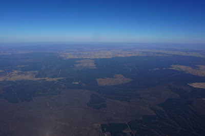
NORTH OF COROWA. Still in the air, still in the game! I’ve been out of radio contact with Ron for hours, and I’ve run out of Riverina Highway to follow - I'm truly flying cross-country now – but there’s scattered farmhouses and dirt roads below. The height of the climbs has continued to improve – I’m getting around 2,000m now and using my gloves and jacket sleeves for the first time. I'm a lot more relaxed now - I've flown over 150km, I've got lots of height, I've just had a muslie bar, a bannana, and a sip of water for lunch - this day is going into my "Great Flying Days Box" now and anything more is a bonus! There’s a very pronounced band of haze on the horizon – I’m not getting near the top of it but the higher I get the harder it is to make out objects on the horizon. Still, it was pretty exciting to fly past Lake Makoan, and I think I can just make out Mt Buffalo and the Glenrowan Gap through the haze. Or maybe I’m imagining it.

I keep the radio volume very low mostly – occasionally turning it off when I’m low and it’s cluttered with traffic like recently. Here's a sample - “yeah, yeah, nah, bring ‘er back a bit George, bit more, bit more, woah, that’ll do ya, nar so I says to ‘im ya mus’ be dreamin mate, what’s it made a’ gold or something – there's a latch on the side matey – and ‘e says it’s nearly new, so I says Yere right, ya mean ten years ago maybe and ‘e says....etc.” You get the idea. I’m sure it’s users like this that inspired privacy codes!

More interestingly, I could hear a flying instructor coaching students on the finer points of ridge soaring and pointing out good thermal triggers for a while - I have no idea where they were or what they were flying but the company was fun.
And I’m at 150km! And there’s still plenty of sunlight left! I’m going to start working north – I know Albury airspace extends out to somewhere near Holbrook? – and starts just after the Hume Highway – maybe I’ll reach that far!

WALBUNDRIE? I’m back near a road, and there’s a small town ahead - Walbundrie maybe? There’s also a small creek which should be good for low saves. The GPS says it’s Billabong Creek - I wonder if it’s the same Billabong Creek that we flew along near Conargo near Christmas?
Back a few km’s I noticed a sailplane circling way below me to the north. There was another one several km’s behind it, then one flew by under me, and just then one flew south a few hundred meters overhead. Fun to have some company in the air - I guess they’re from Corowa, or maybe Benalla.

FURTHER EAST. Another town that I don’t know the name of is passing underneath. The GPS says it’s on the Olympic Highway, it’s got some distinctive silos in the middle of it, and I’m sure I’ve driven through it in the past. But the nice thing about it is the lift it produces – light lift for a couple of km’s past it, then strengthening into one of the best climbs so far. The Hume Highway can’t be that far ahead!!

HUME HIGHWAY. Back in a thermal! Getting low close to the highway I spotted a steep looking ridge facing SW and made a bee-line for it - sure enough there was nice lift over it and I’m climbing steadily as I cross the Hume - several km's north of Holbrook. Looking ahead there seems to be a big patch of bush – I’ll try and edge north of it when I leave this climb.

10 MINUTES LATER, MUCH HIGHER. Well, by the time I topped out in the climb I was over the edge of the trees and committed to the crossing - which looks huge. I should have plenty of height to make it - provided I don't hit lots of sink. There is a possible landing area after about 15km of trees, but with a 40km tail wind I’m not too sure how it’d go – I’d have to line up for the landing area upwind, and if I got blown over it there’d be no flying back around for another pass – wind too strong. Best to stay as high as possible, make it across both patches of bush, and try and decide if I should head further north or further south. I can see the Great Dividing Range ahead!

TUMBARUMBA RD. Further south it is. I dithered for ages over the decision and what decided me in the end was the larger flat areas to the SW – it looks like a much safer area to attempt a possible backwards landing than the rolling hills to the north. There’s a bit of a ridgeline leading SW towards a town – I’ll aim for west of the town and maybe I can fly past the hills past it. It'd be nice to fly as far as possible (there's still enough light for another hour of flying at least) and from here it looks like heading south will let me get further.

APPROACHING TUMBARUMBA. Well, I don't think I'll fly past the town, I’ve been pointing south with the speedbar on for most of the last 20km but the wind is still pushing me east pretty quick and I haven’t managed to track far enough south to take a climb without ending up over hills covered in trees with no landing options downwind. The tree’s below must be releasing the accumulated heat of the day or something – I’ve been flying through lots of patches of light lift, and a few stronger climbs. Ahh well, who’d ‘a thought that taking off from Deniliquin I’d run out of land before I ran out of light and lift? I’ve managed to descend to below 1,000m and should be able to lose the last of my height upwind of the landing paddock I’ve picked. The wind has dropped a little down lower – here's hoping it does so further and I don't have to land backwards.

TUMBARUMBA PADDOCK. It did and I didn’t! Once down to 100m or so I was able to penetrate into the wind and pulled off a nice landing in the top corner of the paddock. Well, I'm sure the cows gave me approving looks! I turned the GPS off (it says I'm 288km from takeoff. 288km!!!!), sent an “I am ok at this position” message on Ron’s SPOT and packed up the wing, buzzing from one of the more amazing paragliding days I’ve experienced!

REFLECTIONS. Most of all I'm impressed by the power of a good windy day – I know that I wasn’t flying particularly fast (for most of the day I circled in anything stronger than 1m/s) but by just staying in the air the wind blew me an amazing distance!

Being very comfortable with the Aspen2 helped a lot, as did all the hours of scratching in light lift on poor days. A couple of musli bars, a bannana, and occasional sips of water helped keep the energy levels up, and taking pics, leaning back and watching the wing on high glides, and fiddling with the GPS provided welcome breaks for the mind. The GPS says that time in the air was 6hrs 35min and straight distance was 288km - with waypoints added the xc distance comes to 301.7km. 300km!!!! That’s just so far past anything I’d planned or dreamed - it's majorly redefined what I thought was possible by a regular pilot on a regular paraglider - even on an extraodinary day.

Checking my flight on Google Earth I can see my ideas of the airspace steps weren’t very accurate – it starts just after the Olympic highway (not the Hume), and while there is a step up that ends near Holbrook it’s the 3,500’ to 4,500’, not the 4,500’ to 8,500’ one I thought. I had some airspace waypoints marked on the GPS, but they were mostly dealing with the airspace sout-east of Albury, and weren't very helpful to the north. Furthermore, I was a bit intimidated by the size of the bush crossing and took the thermal before it as high as it would go, climbing past 3,000m. I'm a bit puzzled by my max height as I remember looking at the XC Trainer when the roughness eased off at the top of the climb and seeing that I was above 3,000m, but I'm sure it said I was a good 300m below what my Garmin recorded. Measuring heights and distances on GE I see that I didn’t need all that height, but then again if I’d flown across lower and hit 3-4min of good sink I might have.

More pics of the flight here.

A very big thanks to Ron for convincing me that today could well be worth waiting for, putting me up for the night, the super tow in the morning, and lending me his SPOT GPS tracker and encouraging me to go big.